
Revolutions in Mapmaking
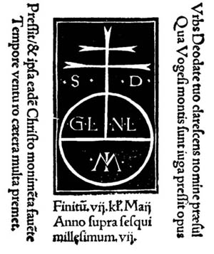
The printer's mark from Cosmographiae Introductio showing that it was printed at the St. Dié press. The "MI" in the circle is for Martin Ilacomylus, as Waldseemüller referred to himself. The mark shows the popular language of the time. What is it?
At the Bell
The 1507 globe gores map at the James Ford Bell Library is one of only four known to exist, and the only one in the Americas. Click Here to Learn About How the Map Came to the University of Minnesota...
The fledgling printing industry sparked by Gutenburg in the mid-15th century had exploded by century's end. By 1500, roughly 200 cities and towns across Europe had printing presses, and scholars estimate that somewhere between 8 million and 20 million books had been printed during the 50 years since the first presses were put into operation. By 1600, an estimated 200,000 different books or editions had been printed in press runs of approximately 1,000 copies each.
The Waldseemüller Maps
The discovery of unknown lands in the Atlantic offered printers and mapmakers a new and exciting topic with which to tantalize the public who had become eager consumers of their work. Waldseemüller's maps and Cosmographiae Introductio, the first products of the St. Dié press, were tremendously popular.
Two versions of the book were published with the maps in April 1507 at St. Dié, each with a different dedication. Two more printings were made that a same year, with other editions produced elsewhere in the years to come. Waldseemüller's use of the name America on the southern continent was copied as early as 1510 by Heinrich Glarean (1488-1563), a Swiss mathematician and geographer, who produced sketch maps with notes that identify his source as Waldseemüller's 1507 planisphere.
Another hand drawn map, this one by Sebastian Münster ca. 1515-18, also picked up the name "America" and these were quickly followed by printed maps produced by Peter Apian, Münster, Orontius Finaeus, R. Gemma Frisius,and others, including Leonardo da Vinci. However, it wasn't until 1538 that Gerhard Mercator applied the name America to both the northern and southern continents.
In addition to the first use of the name America, the Waldseemüller maps of 1507 also are the first to depict the new lands as landmasses separate from Asia; thus they are also the first to depict what would become known as the Pacific Ocean. The James Ford Bell Library globe gores represent another first. This is the first map to represent the earth as a 360 degree sphere. Previous maps, as well as the 1507 wall map, followed the Ptolemy's 180 degrees.
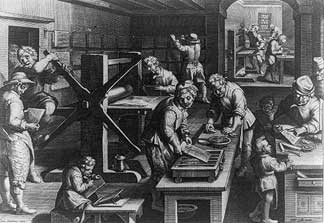 A 16th-century print shop. Engraving by Philippe Galle (1537-1612)
Image courtesy US Library of Congress.