The rhumbs themselves form a network that is both a grid and a compass.
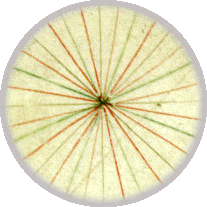
Rose of Rhumb lines

A mile scale is located at the top of the chart.


Use the magnifying glass to see the grid and the scale in the "north" section below.

magnifying glass Under the Magnifying Glass

The 1424 Nautical

north
south
west
East
center

©1999-2001 by the Regents of the University of Minnesota, Twin Cities. University Libraries. All rights reserved. Please credit the James Ford Bell Library, University of Minnesota if you copy or reproduce material from this page.
URL: http://www.bell.lib.umn.edu/index.html