The East - from the Black Sea at the top to the Red Sea at the bottom. Note the scale in the borders, the decorative tents and the holes on the edge for attaching to a wooden pole.
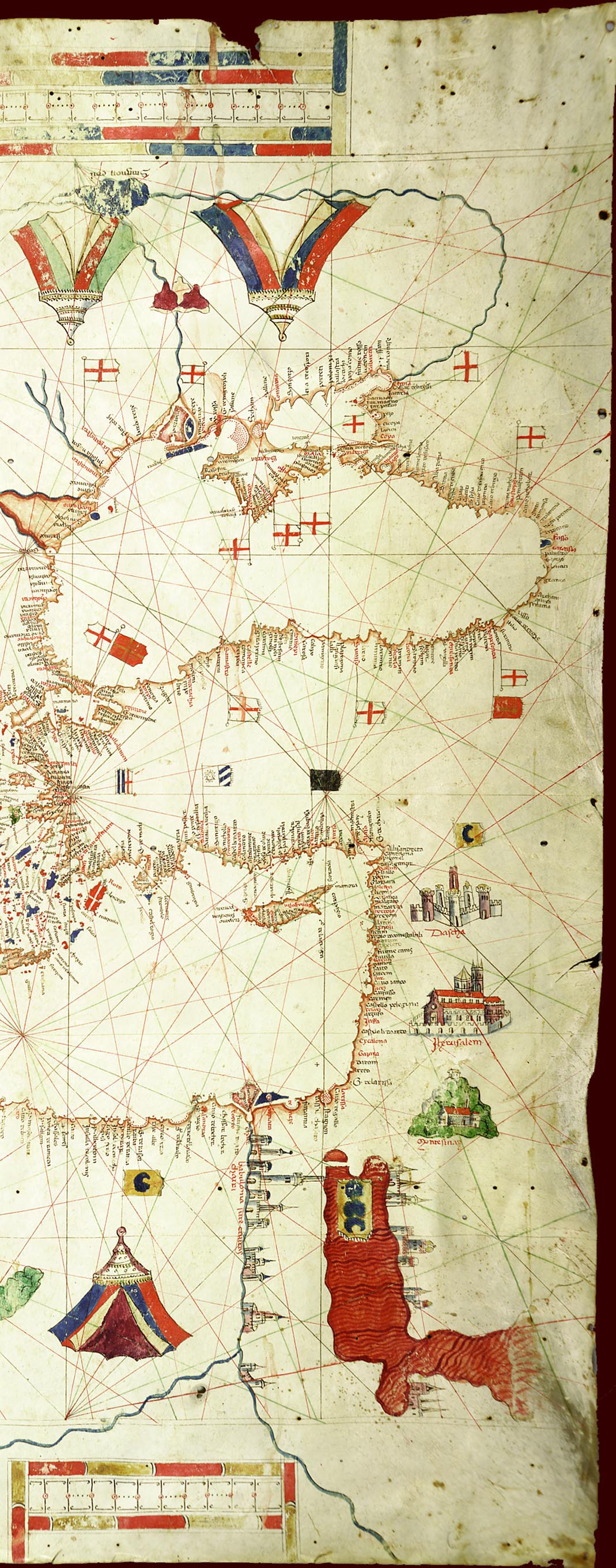
The East - from the Black Sea at the top to the Red Sea at the bottom. Note the scale in the borders, the decorative tents and the holes on the edge for attaching to a wooden pole.
©1999-2001 by the Regents of the University of Minnesota, Twin Cities. University Libraries. All rights reserved. Please credit the James Ford Bell Library,
University of Minnesota if you copy or reproduce material from
this page.
URL: http://www.bell.lib.umn.edu/index.html