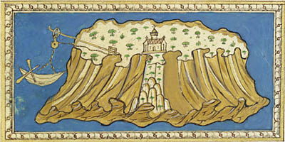
Illustration from Martellus
Some fifteenth-century texts combine illustrations and maps useful
for navigation. One example in the James Ford Bell Library is
a manuscript dating from 1475 by Henricus Martellus. This work
is based on Christoforo Buondelmonte’s Liber Insularium (Book of Islands), which was written in 1420 in Florence.
Illustration from Martellus
The subject of the manuscript is the islands in the Aegean sea. Although the text is closely related to the maps, it is not specifically nautical (Howse 1973, 17 for commentary on the manuscript Liber Insularium in the National Maritime Museum). About Martellus, the writer of the 1475 manuscript in the James Ford Bell Library, little is known except that he was a German cartographer.
He includes a detailed image of Constantinople in the manuscript, as well as a map of England and Scotland. These features indicate the expansion of trade and the attendant geographical knowledge by the third quarter of the fifteenth century. Text dominates in this manuscript.
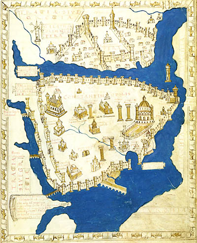
Constantinople in Martellus
Click on map for a detailed version.
©1999-2001 by the Regents of the University of Minnesota, Twin Cities. University Libraries. All rights reserved. Please credit the James Ford Bell Library,
University of Minnesota if you copy or reproduce material from
this page.
URL: http://www.bell.lib.umn.edu/index.html