What is a portolan chart?
Where does that strange name come from? For starters, the word
"portolan" derives from the word "portolani" which is translated
into English as "pilots" or as "rutters." These texts list places,
with distances and directions to reach them. For example, the
James Ford Bell Library has a fourteenth century Italian "Portolano
del Adriatico e Mediterra" which gives sailing directions from
Constantinople to Lisbon. The library also has the first printed
book on navigation, titled Portolano per tutti I navichanti. This
book was printed in Venice by one Bernardino Rizus on 6 November
1490. The colophon of the book states that it was "Composed by
a Venetian gentleman for the use of all navigators who wish to
travel safely." No maps or illustrations appear in either the
manuscript or the book. One advantage of texts is the detailed
information that can be given about dangers, about ports and safe
anchorages, about conditions found on shore and at sea, that cannot
be put on maps.
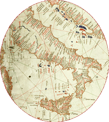
The "chart" element of "portolan chart" makes it clear that what
is being referred to is a map complete in itself, not a map illuminating
a text. The word "chart" derives from the Latin "carta" meaning
napkin or tablecloth. Features that usually appear on portolan
charts include:
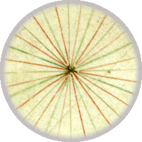
a network of lines made within a circle,
coastlines of lands, place-names,
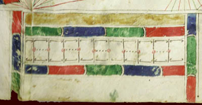
scales of distance,
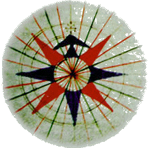
a compass showing cardinal directions,
and indications of shoals, reefs, and islands along coastlines.

Portolan charts were made to get seafarers from home to another
place and back again safely. On portolan charts prior to 1500,
distance, direction, and coastal features were provided for navigators,
with information to enable them to calculate and measure the progress
and direction of their vessels during a voyage; mariners still
had to rely on experience and common sense, however. Modern sea
charts have many of the characteristics that the early portolan
charts have–scale, compass, details of coastlines and harbors
and little detail in the interior.
When all is said and done, defining a portolan or sea-chart is
difficult. Even the definition that these charts were made for
use at sea has its weaknesses, since some of the charts were clearly
made for the use of viewers who never left land. Peter Whitfield
concluded that "Perhaps all we can say to define the sea-chart
is the most obvious fact that the chart is centred on the sea,
and the land is on the margins, rather than vice versa" (Whitfield
1996, pp. 19-20). It should be noted that Whitfield, in his excellent
The Charting of the Oceans: Ten Centuries of Maritime Maps, is discussing sea-charts from very early times to the present,
not just early portolan charts. One important fact about portolan
charts should be stressed: they appeared at the same time that
Europeans began using the magnetic compass.
©1999-2001 by the Regents of the University of Minnesota, Twin Cities. University Libraries. All rights reserved. Please credit the James Ford Bell Library,
University of Minnesota if you copy or reproduce material from
this page.
URL: http://www.bell.lib.umn.edu/index.html