About 1505 Waldseemüller moved to France, to the town of St. Dié
in the Vosges mountains, and the site of a Benedictine monastery.
About this same time a printing press was set up in the town,
under the patronage of René II, Duke of Lorraine. Waldseemüller
soon became active in the Gymnasium Vosagense, a society for the
arts and sciences which also enjoyed the duke’s patronage. The
duke encouraged the collecting of foreign books and maps — including
maps from Spain, Portugual, and Italy — for the society and its
bookshop. Duke René was especially interested in geography.
The leader of the Gymnasium Vosagense, Walter Ludd, was secretary
to the duke as well as the owner of the print shop. Ludd, Waldseemüller,
and Matthias Ringmann — a poet and teacher of Latin who had also
studied with Reisch — planned to publish a fine critical edition
of the Geographia. They borrowed a Greek manuscript of the text from a monastery
and began research on it. The idea was to print the book and its
maps at St. Dié.
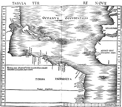
The first task was to compare Ptolemy’s maps with several other
maps and with the writings of Amerigo Vespucci. This proved to
be a very large undertaking, and took far longer than expected.
Although the editing was in process by 1505, progress was very
slow. The printing press was ready. As Waldseemüller wrote: "Therefore,
studying, to the best of my ability and with the aid of several
persons, the books of Ptolemy from a Greek copy, and adding the
relations of the four voyages of Amerigo Vespucci, I have prepared
for the general use of scholars a map of the whole world — like
an introduction, so to speak — both in the solid and projected
on the plane" (Waldseemüller 1907, 34). Possibly the maps for
the edition of Ptolemy were ready for the printer as early as
1507. The text was unfinished, however, and when Ringmann died
in 1511 Waldseemüller gave up the project.
The Waldseemüller/Ringmann edition of Ptolemy’s Geographia was printed at last in 1513 in Strassburg (Strasbourg) by Johann
Schott, another former student of Gregor Reisch, who had been
at Freiburg when Waldseemüller studied there.