A Mapmaker's Life: The Early Years

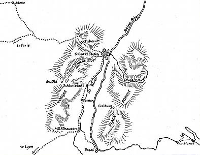
Towns where Waldseemüller lived and worked. Freiburg, Germany
is seen on the left by the Black Forest, and St. Dié, France is on the right near the Vosges Mountains.
Creating the Map That Named America
![]()
In
1507, Waldseemüller created two maps that reflected information the
scholars at St. Dié had received about the discovery of a new continent
in the Atlantic. He produced one map, a globe gores, intended to be
cut out and pasted on a sphere to form a globe, and another map, a
plane chart or flat representation of the earth, designed on 12 panels.
Little is known about Waldseemüller's life. He was born in the village of Wolfenweiler, near Freiburg, sometime between 1470 and 1475. The family moved to Freiburg in 1480 or 1481, and his father, Conrad, became a member of the city council in 1490, the same year that Martin became a student at Freiburg University. At Freiburg he studied cosmography with Gregor Reisch, compiler of the Margarita Philosophica (Pearl of Wisdom), first published in Basel in 1503.
Sometime between 1490 and 1500 he worked in Basel, Switzerland, where the skilled printer Johann Amerbach introduced him to the art of printing woodcut illustrations. During this time he also searched for manuscripts to be used for a revised edition of Ptolemy’s Geographia.
About 1505 Waldseemüller moved to France, to the town of St. Dié
in the Vosges mountains, and the site of a Benedictine monastery.
The Scholars of St. Dié

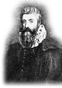
Gautier Lud
The small monastic town of St. Dié had amoung its residents a group of humanist scholars, brought together by Gautier (or Walter) Lud, head of the local chapter of canons and secretary and chaplain to Duke René II of Lorraine.

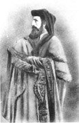
Mathias Ringmann
Other members of the group included Mathias Ringmann, a 22-year-old poet and scholar, whom Lud had invited to St. Dié ca. 1505 to work as a corrector or copy editor of the texts the Gymnasium intended to publish. Jean Basin de Saundacourt, a junior canon of St. Dié, who held the posts of vicar and notary, served the project as translator. Also ca. 1505, Lud invited 30-year-old Martin Waldseemüller to join the group as illustrator, cartographer, and copy editor. Each of these men published their own scientific works, both before they joined the Gymnasium and later. However, the ambitious project for which Lud had recruited them was a new edition of Ptolemy's atlas, the Cosmographiae (Description of the World), which would require all of their collective talents and energy.
In 1507, Waldseemüller created two maps that reflected information the scholars at St. Dié had received about the discovery of a new continent in the Atlantic. He produced one map, a globe gores, intended to be cut out and pasted on a sphere to form a globe, and another map, a plane chart or flat representation of the earth, designed on 12 panels. To aid in the understanding of these maps, the scholars of St. Dié created a small textbook called Cosmographiae Introductio, which they bound with a new edition of The Four Voyages of Amerigo Vespucci, which Sandacourt had translated into Latin from a French copy Lud had obtained from Portugal. It was on these maps and in this text that the name America was first used.


