|
|
|
|
|
|
|
|
|
|
|
|
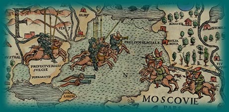
The map of Olaus Magnus is a peculiar and not totally successful blend of Ptolemy’s maps with mariners’ charts. The Scandinavian lands and seas on the map are much better portrayed than they are on earlier maps, but the map is still far from accurate. What the Carta Marina may lack in geography is more than compensated for by its folklore and illustration. The map is filled with images that cry out for explanation and enjoyment. How fortunate it is that two of the original printings of this fascinating map have survived!
![]() Under the Magnifying Glass: Olaus' Carta Marina
Under the Magnifying Glass: Olaus' Carta Marina
©1999-2001 by the Regents of the University of Minnesota, Twin Cities. University Libraries. All rights reserved. Please credit the James Ford Bell Library,
University of Minnesota if you copy or reproduce material from
this page.
URL: http://bell.lib.umn.edu/index.html