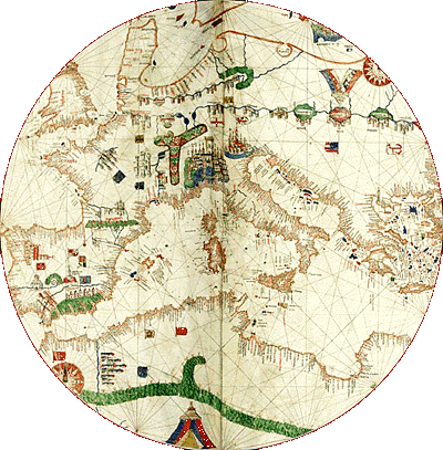
The first is nearly 25 inches in diameter, the second larger, about 35 inches, enclosing the smaller circle. Both circles have the same central point.
The larger circle appears only on the eastern portion of the map (eastern Africa, the Near East, and northern Europe) and the western area, where a row of islands appears north/south in the Atlantic Ocean along the western side of the portolan chart.
Use the magnifying glass by clicking on the compass roses at the
bottom of the page. ![]()
The 1489 Canepa |
 |
 |
 |
 |
 |
©1999-2001 by the Regents of the University of Minnesota, Twin Cities. University Libraries. All rights reserved. Please credit the James Ford Bell Library,
University of Minnesota if you copy or reproduce material from
this page.
URL: http://www.bell.lib.umn.edu/index.html