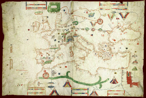
This portolan chart is made on two skins, equal in size (about two by two and a half feet each) joined in the center to form the large rectangular map.

Was a chart of this size and beauty meant to be used at sea? Possibly and possibly not. Does beauty belie usefulness? The holes along the eastern edge appear to indicate that it was attached to a wooden roller, and wormholes running through parts of the portolan chart indicate that it was rolled for at least some of its existence, either for storage or while at sea.
[To see the details of the map, click on a compass rose below.
The images will be very large and will appear in a separate window.]
![]()
The 1489 Canepa |
 |
 |
 |
 |
 |
©1999-2001 by the Regents of the University of Minnesota, Twin Cities. University Libraries. All rights reserved. Please credit the James Ford Bell Library,
University of Minnesota if you copy or reproduce material from
this page.
URL: http://www.bell.lib.umn.edu/index.html