The Changing Shape of the Earth
![]()
![]()
![]()
![]()
![]()
![]()
Two peculiarities in the presentation of Europe are noteworthy. These two features appear in Ptolemy's Geographia..
Ptolemy the heel of Italy's boot hangs in an odd manner. Ptolemy
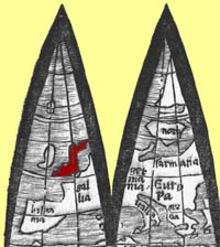
Scotland has a strange hook in the northeast;
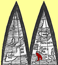
The southern point of Africa, which in reality is about 35 degrees south, is at 50 degrees south.
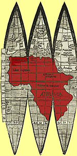
Waldseemüller adopted Ptolemy's estimate of the size of the earth, which was about a fifth smaller than its true size. Thus Africa extends further south, and the oceans are smaller.
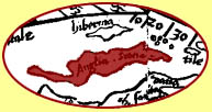
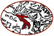
Printed versions of Ptolemy’s world maps show the south part of Africa connected to southeast Asia, enclosing the Indian Ocean by land.
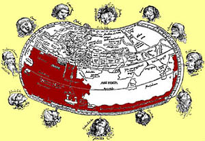
In contrast, on his globe Waldseemüller depicted open water around Africa.
![]()
The Globe |
 |
 |
 |
 |
©1999-2001 by the Regents of the University of Minnesota, Twin Cities. University Libraries. All rights reserved. Please credit the James Ford Bell Library,
University of Minnesota if you copy or reproduce material from
this page.
URL: http://www.bell.lib.umn.edu/index.html